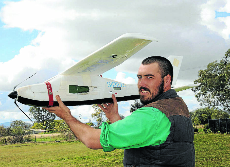
A PIECE of ground-breaking surveying equipment that can scale the skies at 120 metres, operates from a laptop and by remote control, is making inroads in the industry.
Subscribe now for unlimited access.
$0/
(min cost $0)
or signup to continue reading
Gunnedah’s Stewart Surveys have one of only a few Unmanned Aerial Systems (UAS) light surveying aircraft that is operating in NSW, and is complete with an on-board high resolution camera that can cut previous workloads dramatically.
The aircraft – also known as a drone – is continuously monitored by a ground controller who can take manual control and land the plane at any time, with the end result being high resolution aerial photographs and detailed digital elevation models.
Lincoln Stewart is the sole operator of the small aircraft in Gunnedah which measures 1.6 metres wide and one metre long.
He says it’s a game changer in the surveying industry which can be utilised for a range of projects, including contour/topographic surveys, volume calculations, environmental reports, stockpile volumes, open cut pit surveys, accident and hazardous site plans and corridor surveys of roads, pipelines and power lines.
Operating for just six months, the equipment has been breaking ground in the local area, having undertaken stockpile, rehabilitation and open pit surveys for the local mining industry, a quarry in Port Macquarie and a flood study survey for a vineyard at Pokolbin where the client wanted levels and photography for flood level analysis.
The unmanned aircraft works like this:
From a laptop in the office, an operator like Lincoln Stewart sets up a flight plan and manually selects co-ordinates. From that, it will automatically produce a flight plan, the accuracy and what height it flies at. The operator can change certain aspects like wind direction or calculate the shortest route.
“It automatically calculates the flight route. The way it does the survey is by taking a series of photos, which may be around 1500 photos, and then it overlaps by 85 per cent and that brings them together in a 3D effect. It’s called photogrammetry,” Mr Stewart said.
“When we’ve got the flight plan organised, we have to lay out ground control targets, and that ties it to a co-ordinate system and gives accurate heights. Then we fly it.
“I set up the ground control station and laptop, transmit the flight plan to the plane and its right to launch.”
Once it’s released into the air by the controller, the unmanned small aircraft circles above, before reaching its desired height, and flies up and down along the flight lines taking photos that are stored on an SD card. Once it returns to the landing area, the data can be downloaded for processing.
“I can track it at all times on the laptop, where it’s up to, what it’s done and the battery percentages,” Mr Stewart said.
The technology has proved hugely beneficial with both cost and time savings.
“The other thing is that for some jobs that are not readily accessible we’re getting a lot more and accurate data then conventional methods like GPS.
“What we’re doing is getting every little nook and cranny. With the GPS, we couldn’t do that before, you’d be there for days and you’d have to average it a bit.”
The UAS is just another tool Stewart Surveys has to offer as surveyors can use it to obtain geo-referenced othophotos and point data to do calculations in much the same way as they do with conventional instruments.
It does have some limitations with things like tree cover. If there is an area completely covered in trees, it won’t pick ground levels up beneath trees and buildings.
The surveyors rely on conventional methods for other projects, however the Stewarts are integrating the new piece of technology into their business and much of the time the data collected can be integrated.
The results are speaking for themselves, however the process to have the aircraft up and running was long winded and expensive.
Mr Stewart needs a private pilot’s licence, along with a controllers certificate and operators certificate issued through CASA.

